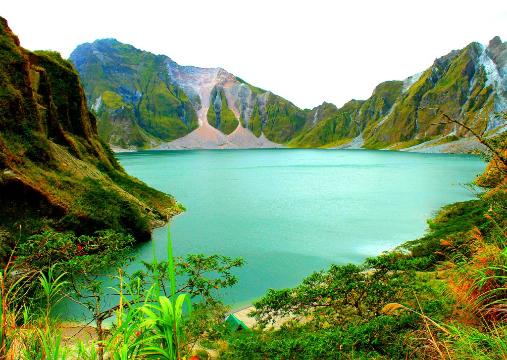

June 15, 1991. This volcano once claimed many lives. It then left a beautiful lake in its wake. The crater of Mount Pinatubo in Zambales may evoke words such as calm and serene now. But it will always have a horrible past. Mount Pinatubo erupted and overwhelmed nearby areas with pyroclastic flows, ash deposits and lahar — a mixture of pyroclastic material, rock sediments and water.
To make matters worse, another natural event coincided with the eruption: Typhoon Yunya. More than 800 people died after the volcanic eruption and the subsequent lahar mudflow that reached as far as Pampanga. Many of the evacuees and survivors had no homes to return to. It was hell on Earth, if ever there was one.
June 21, 2014. 23 years after the explosion, I joined a trek to the mouth of Mount Pinatubo. The trek follows the former path of the lahar. Truth be told, I was not expecting myself to be drawn to its tragic history; I was just there to enjoy the trek.

Start Trek
At 6AM, our journey towards Mt. Pinatubo started. We rode a 4×4 which took us from the ETA Tourism Office to the jump-off point. The ride allowed us to get a glimpse of the growing vegetation in what was lahar territory.
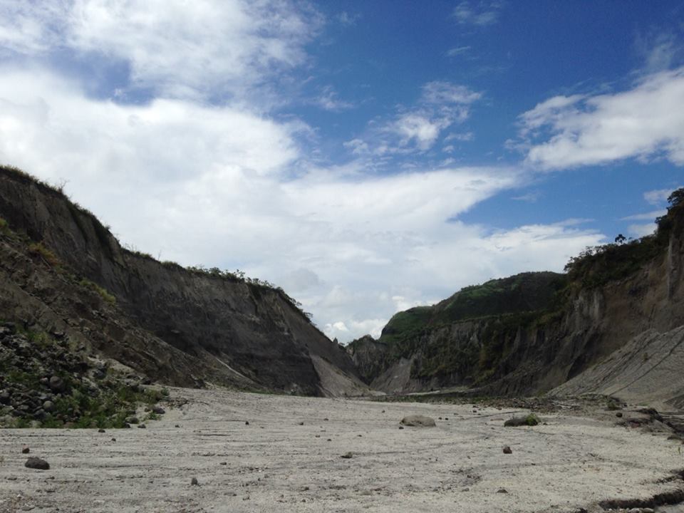
But one thing I noticed: the path was slowly transforming from a lush plain to a canyon of barren cliffs with nothing but rocks. We drove through a gray river that seemed like the River Styx. Then we passed by more cliffs filled with more rocks. An hour after riding the 4×4, we stopped at the edge of a clearing. A wooden sign greeted us: Welcome to Botolan, Zambales.
Next to it was a path hidden behind a tall rock formation. Our trek started.


I tightened my trekking shoes, checked my bag and put on a hat. We started our trek at 7AM. The path was surrounded by cliffs on both sides. It was a canyon with rock formations as massive as a sleeping giant.

The area was littered with rocks of pale grey. Some of which seemed to transform into human forms out of the corner of my eye before becoming rocks again. There was no sound, except that of the river, our footsteps and the echo of rocks falling in some distant area. A solitary shed along the pathway pops up every kilometer or so. The group took rests there before moving on.
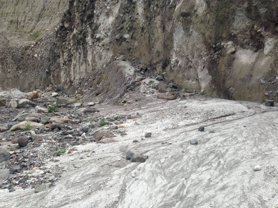
Our guide mentioned that the path was once a lush area where the Aeta tribe settled. This was before the lahar reshaped and carved everything in 1991. Now, the place is desolate. Lahar sediments hardened and cemented whatever was with it or under it. Erosion slowly chipped away some of the sediments and revealed layers of vegetation covered by a cement-like substance. It was as if a certain time was laid buried under the watery ash and that the cliffs only started revealing the tragic past that laid beneath the rocks.

Tales of Wonder
We encountered Aeta kids along the way. They were idly passing the time while their mothers were washing clothes at a nearby river. I waved to them; they waved back. They could not be there when the eruption happened. They are too young. But they could have had relatives or friends who witnessed the event.
I wondered if their mothers told them stories of powerful gray floods or days when the sky was dark and the sun did not appear. I wondered if they were told about their relatives who died before they were born. I wondered what tales they heard over dinner or before going to sleep.
And I wondered why they were smiling.

The Crater
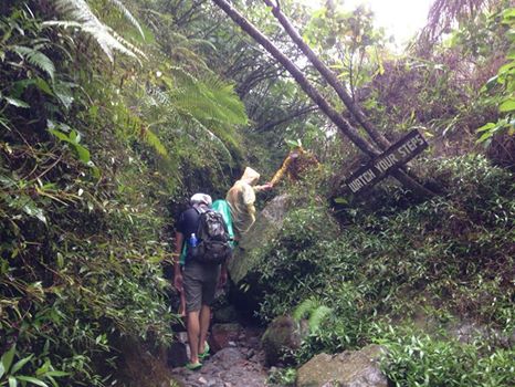
The path was slowly turning uphill. The arid canyon turned into a forest. However, the river was still there to show the way. The weather, this time, turned gray. By the time we were reaching our destination, it started raining. And in an instant, the path became slippery. But we pushed forward. Some wore rain coats; while some, like yours truly, relied on an umbrella. We climbed over wet rocks and muddy trails until we reached man-made steps that lead to the crater of Mount Pinatubo.


It was 9AM when we reached the crater. There was no burning pit or gaping hole into an abyss. There was no rocky surface. Nothing but a lake, as calm as a field and as green as a tree. It was paradise on Earth. Nothing more.

A Clean Slate
We rested on a beach beside the lake. We talked, took photos, ate our lunch and waited for the rain to weaken. When the rain finally stopped, we prepared our things and started heading back. I took one last look at the lake.
It was then that a thought occurred to me. This lake was there because of the eruption that happened in 1991. Even after all the devastation in the area, nature has its way of getting back on its feet and moving on. It is tabula rasa. A rebirth of sorts where everything is wiped clean and everything has the chance to start again. The lake or a growing shrub or a smiling kid is paying homage to that.

On our way back, our guide mentioned that he was 5 years old when the tragedy happened. He was just a kid then. But he remembered how the eruption erased everything in an instant. It was a gray chapter in his life. Now, he is one of the local guides who accompany tourists into Mount Pinatubo. And this growing industry of sustainable tourism is helping reinvigorate his town.
It was also his birthday. We greeted him. He stared into a distance — and he also smiled.

[Entry 19, The SubSelfie Blog]
About the Author:

Justin Joyas is a contributor for SubSelfie.com and was part of the original roster that founded the site. Presently, he is a User-Generated Content Producer for YouScoop and GMA News. He also studied Mobile Journalism at Konrad Adenauer ACFJ. He’s a newsroom ninja and protector of the realm who also wanders a lot. Literature 2008, DLSU. Read more of his articles here.


Leave a comment